Soak in the vast, spectacular, vast and vibrant landscape of the Devil’s Punch Bowl in the southwest of the Surrey Hills. If you’re feeling adventurous, don’t hesitate to explore the breathtaking scenery at Highcombe Edge and Gibbet Hill.
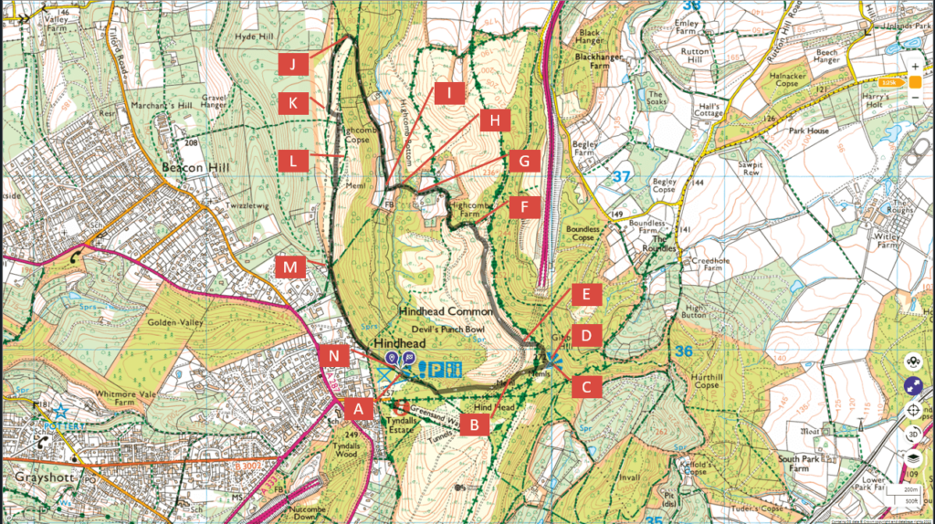
Follow the entire walk on . The route map is available on
.
According to local legend, the Devil scooped up a handful of earth and flung it at Thor, the God of Thunder. The resulting depression left behind is the famous Devil’s Punch Bowl itself!
The National Trust provides excellent self-guided walking trials at the Devil’s Punch Bowl [URL to scan]. This walk is inspired by a combination of their Sailor’s Stroll and the Highcombe Hike with ideas from Roam 639.

The timeline of the waypoints on the video are:
A 2:30 Start Visitor Centre
B 18:34 Sailor Stone
C 23:44 Gibbet’s Hill
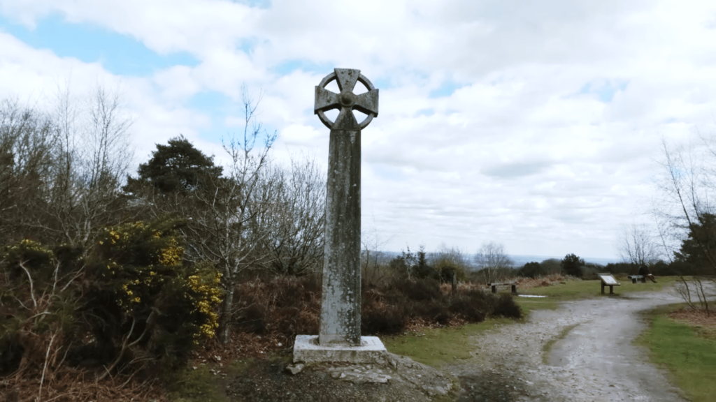
D 25:52 Celtic Cross
E 32:56 Old A3
F 49:17 Tarmac track
G 1:00:29 Price Cottage
H 1:01:54 Footbridge over the stream
I 1:03:20 Rejoing Highcombe Hike
J 1:24:41 Sharp left bend
K 1:34:56 Path uphill
L 1:37:02 Highcombe Edge
M 1:54:46 Cattle grid
N 2:12:26 End Visitor Centre
Begin your walk from the Visitors’ centre viewpoint and head towards a gate on a path that turns sharply to the left after a few metres, crossing the grass track to reach a paved road. On your way, you will pass Sailor’s Stone on the left. It tells the gruesome story of a murdered sailor in 1786.
After about 30 metres, bear right on a footpath towards Gibbet Hill and enjoy a stunning view, including the skyscrapers of London on a clear day.
Walk towards the Celtic cross and turn right to reach the paved road again. In about 20 metres, look for a small path on the left leading downhill to a wide footpath. Here, take in the view of the Devil’s punch bowl, looking westward towards the viewpoint at the Visitors’ Centre where you started the walk. The old A3 pass over this wide space. The new A3 is now a tunnel that is about 70m below where you are standing.
Follow this path until you pass through a gate taking you out of the Punch Bowl. Continue until you see a tarmac road on the left that snakes downhill, with Highcombe Farm on the right. Near the bottom, take the left path towards [Price] cottage at the fork. The right path outside the [name] cottage gate leads down towards a stream with a footbridge.
After the bridge, the path heads steeply upward until you reach a gate. * Turn right and walk along the trail, which is part of the Highcombe Hike. You can see horses to your left. In about 400 metres, take the left fork that leads uphill for approximately 300 metres before taking a sharp left beneath the power lines. Continue for 400 metres until you see a small path on the left that takes you uphill through a small wooded area.
Turn right and continue on the ridge, appropriately named Highcombe Edge, until you reach a cattle grid. Continue on this footpath until you return to the Visitors Centre, where you began.
* You can turn left to take a shorter route back to the Visitors’ centre. Enjoy a great view of the Devil’s punch bowl looking eastward from here.

