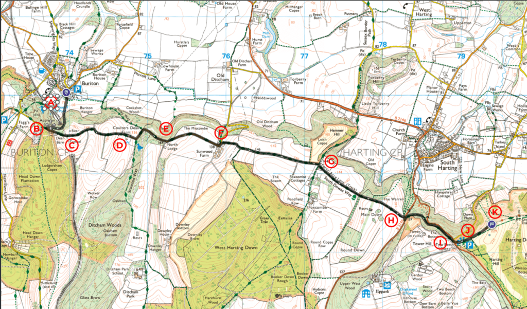
This walk from Buriton to Harting Down along the South Downs Way is about 7 km with a total ascent of 230 metres. It begins at St Mary’s Church [A] in the idyllic village of Buriton.
Follow the entire walk on . The route map is available on
.

A: St Mary’s Church
B: Start of our walk on the South Downs Way
C: Dean’s Farm
D: Dean Coulter Farm
E: Three-way junction
F: Sunwood Farm
G: Start of Forty Acre Lane
H: South Downs Way meet B2146
I: Viewpoint across the valley
J: Harting Hill
K: Harting Down
Cross the field to the church’s right and follow the steep, forested footpath. Along the way, you might glimpse trains passing below in the valley. You reach the start of South Downs Way at the top of the ridge [B]. Turn left and head east.
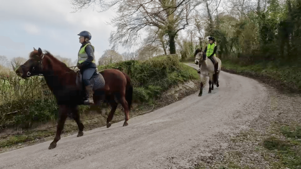
The track becomes a footpath as it forks rights at Dean’s Farm [C]. The South Downs Way continue on this wide footpath with rises gently over a distance of 1 km to rejoin a track at Dean Coulter Farm [D] . Here be prepared to meet riders in the morning.
Continue for another 500 metres to reach a three-way junction [E]. The track on the right leads to a Ditcham Park School [x-ref]. Straight ahead is the view of the field sloping away to the left and the North Lodge to the right of it. South Downs Way continue on to the left and downhill toward Sunwood Farm [F].
At Sunwood Farm, follow the fingerpost for the South Downs Way to the right just as the track road begins to go downhill to the left. Continue on this footpath to be treated to a view of the field to the left and right. You arrive at a cross road in about a kilometre. [G]. The hut on the left has a tap (if you urgently need water). South Downs Way continue straight ahead.
The path, also known as Forty Acre Lane on the OS map, continues through undulating pastures until it reaches the B2146 [H]. Cross the road and bear left. A sign here warns that you are entering an ancient woodland where it is unsafe to enter during times of high winds!
The South Downs Way then skirt around Tower Hill on the right and rises 50 meters over a span of half a kilometre: 10% gradient. As you near the top [I], take a moment to admire the stunning view across the valley to Down Place nestled in the woods and the village of South Harting to its left. Cross the B2141 and continue uphill before opening up to an open field of Harting Hill and the public car park [J].
Continue on 100 m to enter the gate into Harting Down [K]. In winter and early spring, without the foliage shrouding the sight, you get a spectacular view across the valley to the village of South Harting, East Harting and, further right, Elsted.
We hope you’ve enjoyed this part of the walk and the South Downs Way, and be sure to join us for the next video where we continue our journey.
* South Downs Way: Buriton to Steyning
This video is the first of a series of a walk along the South Downs Way, covering a distance of 57 km over three days from Buriton to Steyning. Please check the blog and accompanying highlight video posted on .

