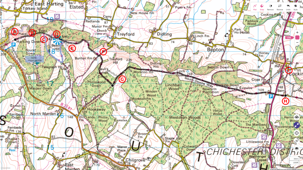
This journey along the South Downs Way is from Harting Down to Cocking, covering a distance of 10 km with an ascent of 260 m.
Follow the entire walk on . The route map is available on
.

A: Harting Down
B: Gate leaving Harting Down (not shown on video)
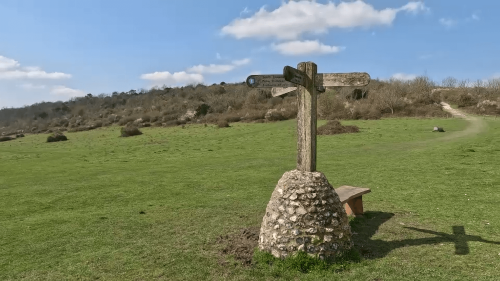
C: 4-way signpost
D: Peak of Beacon Hill
E: Pen Hill
F: Buriton Farm
G: Devil’s Jumps
H: Manor House
I: St. Catherine church at Cocking (see Highlight video 1:53)
Starting from where we left off, we walk uphill on Harting Down [A]. At the top, you’ll find a swing gate [B], and the South Downs Way continues downhill on a wide chalky path.
As you walk along, you’ll come across a plain where grass has grown over the chalk path and a 4-way signpost [C] marks where two other footpaths cross the South Downs Way. Here, you have a choice to make. Straight ahead (eastwards) is a steep climb towards Beacon Hill (242 metres), while the South Downs Way skirts around Beacon Hill, heading southward more gently for about 800 metres before turning north to rejoin on the other side of the hill.
If you’re up for a challenge, we recommend taking the route directly up to the peak of Beacon Hill [D]. The climb is arduous, but the stunning view from the top makes it all worth it. Once you catch your breath, continue to the saddle between Beacon Hill and Pen Hill [E], where the South Downs Way rejoins from the right. As you near the peak of Pen Hill, the path becomes more distinct and chalky once again.
The path down is gentle, with a view of the broad valley straight ahead. The South Downs Way bears left into woodland as the terrain flattens. Turn right at the junction where it meets another footpath. The way meanders gently through the woods before emerging onto an open field.
After passing Buriton farm [F], the South Downs Way turns right and rises as it heads back into the wood, where it flattens out again. Continue until you reach and meet another footpath from the right. Turn left, and in about 300 metres, you’ll arrive at Devil’s Jumps [G]. This site is listed as a Scheduled Ancient Monument and a Local Nature Reserve and is considered one of Sussex’s best-preserved Bronze Age barrow groups.
As you continue on the South Downs Way, you’ll emerge from the woodlands onto grazing fields with ewe sheep and their lambs (April is the lambing season). The path here is broad, and the view remains the same for about 2 kilometres. Then, the terrain falls away, and the view opens up. In the distance, you’ll see Cocking on the left.
Please note that walking on the A286 to Cocking is not advisable due to traffic and the lack of a proper footpath. Instead, cross the road and continue on the footpath directly ahead for 200 metres until you reach the manor house [H]. The path to the left will take you safely to Cocking, where you’ll arrive at a small river flowing placidly beside the St Catherine of Siena [I], a church with a history dating back to the 11th century.
We hope you’ve enjoyed this part of the walk! Join us for the next video, where we’ll continue our journey along the South Downs Way.
* South Downs Way: Buriton To Steyning
This video is the second in a series of a walk along the South Downs Way, covering a distance of 57 km over three days from Buriton to Steyning. Please check the blog and accompanying highlight video on .

