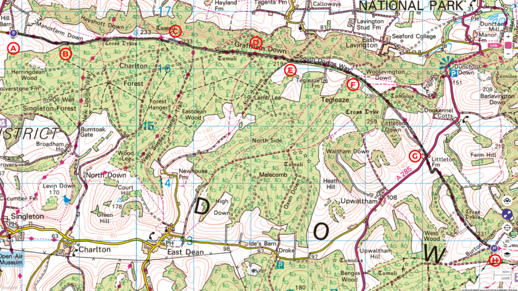
Our journey on the South Downs Way continues from Cocking to the Slindon Estate. The route covers a distance of 10 km with an ascent of 300 m.
Follow the entire walk on . The route map is available
.

Waypoints
A: Manor House and Shepherd’s Hut
B: View looking back at Cocking
C: Tumuli (Bronze-age burial mound)
D: Sign describing Graffham Down
E: Crossroad of footpaths at Graffham
F: Crossroad of footpaths at Tegleaze
G: Campsite with cafe and waterpoint.
H: Slindon Estate with Gratting Beacon to the left
Starting from the manor house [A] in our previous video and blog, we proceed uphill along Hillbarn Lane, passing the sawmill on the right. The track gradually becomes a broad footpath and continues to rise gently. On the right are fenced-up pastures with sheep and their lamp. Look back occasionally to enjoy the sight from a higher vantage point [B].
After 2.5 kilometres, you arrived at a cattle grating on your left. Enter and follow the path that turns right. On the left, you pass several tumuli [C] or bronze burial mounds from the Bronze Age. Take note of the sign [D] describing that epoch’s archaeological features. You are now in Graffham Down.
Most of the way on Graffham Down is flat. In a further 2.5 kilometre, the South Downs Way meet the crossroad with two other paths [E].
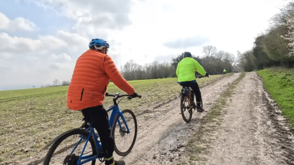
Continue straight onto a track of open space bordered by woods, with the South Downs Way passing through the middle. This is a popular path with cyclists.
You enter a small wooded area near Tegleaze where several paths again cross the South Downs Way. A gate opens into a field on the far side of this wood. Walk toward a signpost about 50 metres straight ahead. As you near it, the view opens up as the land falls away into Littleton Down. In the far distance, you can see the tower of Glatting Beacon with the South Downs Way winding up to it (next video).
For the next kilometre, the South Downs Way heads straight for the A285. Even as you soak in the view ahead, take advantage of the views to either side of Littleton Down or look back up the hill. A camping site and cafe [G] are situated just before you cross the A285.
South Downs Way continue across A285 and gently up toward the woods. Just before you enter the woods, turn and look back toward Littleton Down’s top and marvel at the sight of the rolling hills and South Downs Way that led you here.
The wide path of the South Downs Way continues rising, and the wood soon opens to fields and pasture. Near the top, you can see the Gratting Beacon up close. The gate here opens into the Slindon Estate [H].
* South Downs Way: Buriton To Steyning
This video is the second in a series of a walk along the South Downs Way, covering a distance of 57 km over three days from Buriton to Steyning. Please check the blog and accompanying highlight video on .

