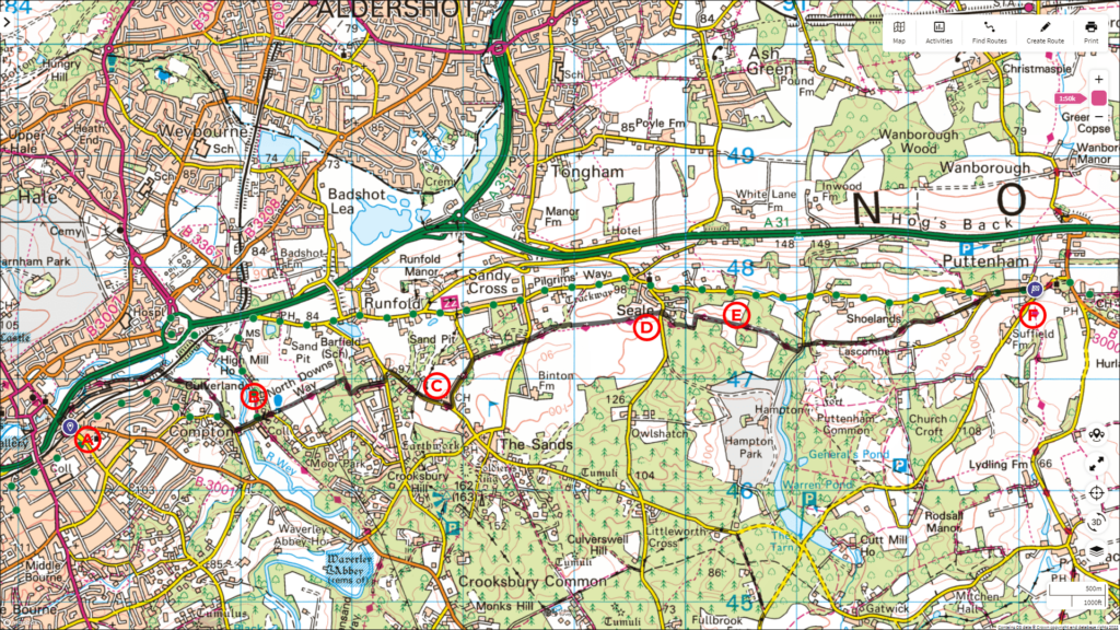
Come and join us for an unforgettable stroll along the breath-taking North Downs Way. This captivating walk will take you on a journey spanning 10.5 km, allowing you to immerse yourself in the beauty of the surroundings over 2.5 hours.
Follow the entire walk on . The route map is available on
.

Waypoints
A:Farnham train station
B:Moor Park House
C:Farnham Golf Club
D:Seale Village
E:Waggoners Campsite
F:Puttenham
Welcome to the first instalment of our exhilarating walk along the North Downs Way! This four-part video series will take you on a journey spanning two days, the 20th and 23rd May. Lace up your walking shoes and get ready for an adventure!
In this first instalment, our walk begins at the Farnham train station [A]. Walk down Station Hill for about 80 metres and turn left into a narrow footpath at the end of a row of shops. At the end, turn left onto The Fairfield. Follow this road for about 400 metres and then turn left into a narrow footpath between houses that leads downhill. Turn left again and join the North Downs Way at the end. (Another way to join the North Downs Way is to continue walking down Station Hill until you reach the A31. Turn right and walk 100 metres to Darvills Lane. This is the official start of the North Downs Way).
Continue for about 500 metres, walking beside the gently flowing River Wey on your left. Then, the North Downs Way turns right under the arch of a railway bridge and continues into the enchanting woods. In about 1 kilometre, you’ll exit the footpath onto Moor Park Way at Compton. Turn left and continue until you reach a T-junction. Take a left at the T-junction. Please note that this turn of the North Downs Way is not well sign-posted.
Soon, you’ll cross a bridge over the River Wey again with Moor Park House [B] on the right, featuring a sign for “The Walled Garden.” Continue straight on, gently uphill, keeping an eye out for a finger post indicating the North Downs Way footpath and a kissing gate. After passing through the kissing gate, the view opens up to pastures before heading back into the woods. When you reach the next T-junction, turn right to follow the North Downs Way. After another 100 metres, take a left and soon you’ll reach Crooksbury Road. The North Downs Way continues on a short footpath to the left, crossing the road. It then meets Sands Road.
Turn right here and continue walking on the road for about 600 metres until you reach the Farnham Golf Club [C]. Turn left after the club’s carpark and continue walking on the right side of the road. In about 5 minutes, you’ll spot the footpath for the North Downs Way on the right.
The North Downs Way continues in an easterly direction, crossing Binton Lane before finally arriving at Elstead Road in Seale Village [D]. Cross the road and rejoin the North Downs Way in about 20 metres on the right.
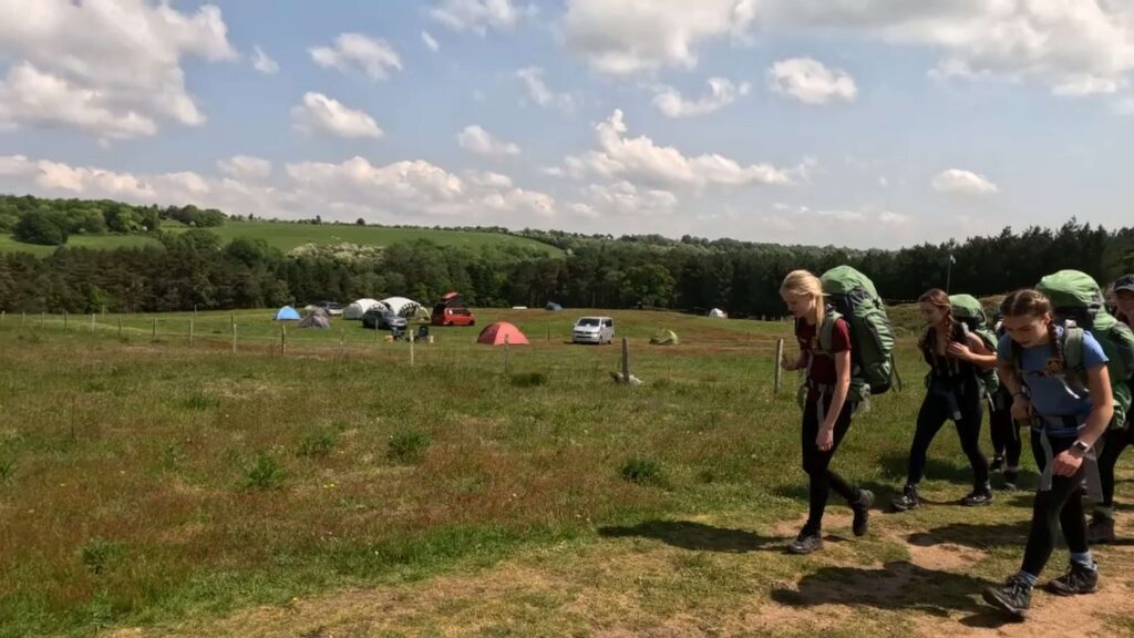
After approximately 400 metres, you’ll pass through a kissing gate. Take a moment to enjoy the view as it opens up to the valley below and the Stony Hill, a short distance to the north. At the end of the pasture, you’ll pass through another kissing gate, leading you into the Waggoners Campsite [E].
For the next 40 minutes, the North Downs Way continues in its easterly direction, taking you through Totford Wood and Lascombe Farm before arriving at Puttenham [F].
Click here to continue the journey from Puttenham to Albury along the North Downs Way in the next blog.

