We extend an invitation to join us on a leisurely walk along the North Downs Way, a haven of natural beauty. Traverse 9.5 km at a relaxed pace over 2.5 hours, immersing yourself in the captivating surroundings and creating lasting memories along the way.
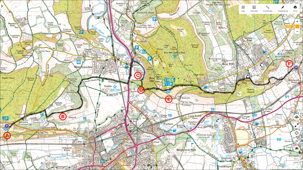
Follow the entire walk on . The route map is available on
.

Waypoint
A:Ranmore Common
B:Denbies Vineyard
C:Burford Meadow
D:Stepping Stones
E:Viewpoint from Box Hill
F:Bletchworth
Welcome back to our North Downs Way adventure! This video is a continuation of our walk that started from Farnham, with the previous video ending when we arrived at Steer Field near Ranmore Common [A].
Continue on the footpath at Steer Field, heading eastward for about 200 metres until you come to a group of houses. Follow the footpath beside the houses until you reach Ranmore Common Road. The North Downs Way continues across the road, passing by St. Barnabas Church on the right. In about 600 metres, after Denbies House, the North Downs Way turns right and then left again.
Continue on this path for about a kilometre, where you’ll see Denbies Vineyard [B] on the right, with Dorking in the foreground. The North Downs Way curves first northward and then continues its easterly direction until you reach the very busy A24. Due to safety concerns, it is not recommended to cross the A24 here. Instead, turn left and walk about 400 metres to the subway. Once on the other side of the underpass, turn left and then right again into Burford Meadow [C]. This way of rejoining the North Downs Way is more pleasant and picturesque than walking back along the A3.
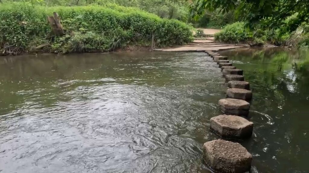
(This section is not included in the video. You’ll pass by Burford Lodge on the right and cross the Stepping Stone footbridge over the River Mole.) Continue for 50 metres, and you’ll arrive at the North Downs Way again. Visible on the right are the Stepping Stones [D].
Turn left here and follow the long, steep steps toward Box Hill. The average incline here is about 25% over a distance of approximately 500 metres. Fortunately, there are several rest points along the way to the top.
After the challenging climb, you’ll be rewarded with a commanding view from the top of Box Hill [E]. From here, you can see Dorking and the hills beyond.
The North Downs Way continues eastward from the viewpoint at Box Hill. The path first runs alongside Zig Zag Road for about 500 metres. For the next kilometre, the North Downs Way descends slightly, then turns left and starts climbing again to an elevation of over 212 metres. This will be the highest point on this walk, and conveniently, a bench is placed here for you to catch your breath.
From there, the path turns right and descends mostly downhill. Finally, you’ll arrive at a kissing gate and then the houses of Betchworth. Our walk ends when you reach Pebblehill Road (B2032).
Stay tuned for more exciting adventures on the North Downs Way in our next video!

