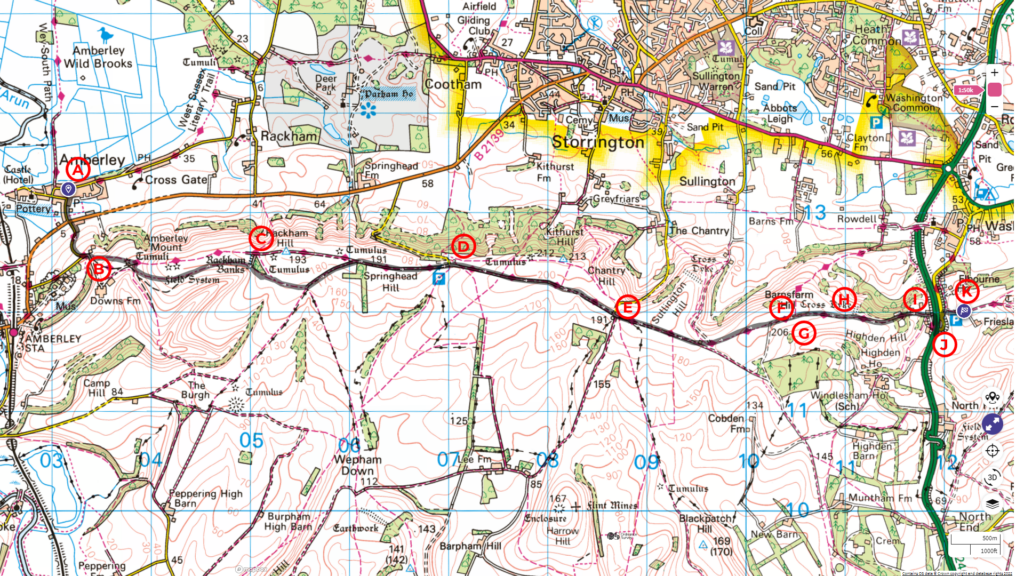
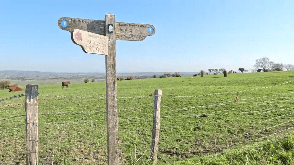
Our walk on the South Downs Way starts from the village of Amberley to Wiston Estate, covering a distance of almost 11 kilometres with a total ascent of 280 metres.
Follow the entire walk on . The route map is available on

Waypoints
A: Leaving Black Horse pub
B: Fork left at Highdown
C:Mound with a view
D: Kithurst Hill car park
E: Chantry car park
F: View of Storrington
G: Barnsfarm Hill
H: View of Chanctonbury in the distant
I: Watering point
J: Crossing A24 carefully
K: Wiston Estate car park.
This walk continues from the previous video and blog.
Amberley is not directly on the SDW. However, many walkers spend the night here because it’s an idyllic English village with excellent accommodation and food at the Black Horse gastropub.
Our walk starts from the Dark Horse pub [A] and heads downhill out of the village, crossing the Great Barn Road (B2138). The track after you cross the road takes you uphill. In about 300 metres, you arrive at the SDW, which joins from the right. Turn right onto SDW, and at Highdown, take the left footpath [B] through a short wooded section.
After the gate at the top, the view opens up on pasture on the left and right. As you make your way gently up, remember to look back as you get an increasingly commanding view of the valley behind. Straight ahead is Rackham Hill (193 metres).
As you near the crest of Rackham Hill, a gate on the left opens to a small mound [C]. Clamber up and take in the majestic sight of the valley below. Return by the same gate back to the SDW. (Another gate further left leads to a pasture that is on the other side of the fence of the SDW. There may not be another gate to get you back on the SDW).
The following two kilometres are flat, with an open view of the valley on all sides before you arrive at the car park of Kithurst Hill [D]. The hill itself is another kilometre or more ahead on the left.
You arrive at the Chantry Post car park [E] in another kilometre, a busy and popular location for short circular walks. We saw a group training their dogs. Chantry Lane, which leads to this car park, is a steep climb, and some cyclists are up for such a challenge.
Leaving through the car park through a gate ahead takes you into wide open pasture. After you pass a cattle grating, the view on the left opens. On a good day, you can see Storrington [F] nested in the valley three kilometres away as you make your way up Barnsfarm Hill [G]
After the crest of the hill, SDW takes you through a gate and almost directly straight ahead, you can see Chanctonbury Hill [H] 3 kilometres as the crows fly.
South Downs Way heads gently downhill for 800 metres until you enter a wooded area. There is a watering point [I] just before you reach A24. Be sure to top up as the next section of our walk takes up the steep climb to Chanctonbury.
The SDW quickly becomes a track that bears left before arriving at the very busy A24 and continues on the other side of the dual carriageway. On the near side, cars are coming fast around a bend [J]. Please take extreme care.
After crossing A24, turn left on the SDW until you arrive at the Wiston Estate car park [K].
We hope you’ve enjoyed this part of the walk! Join us for the following video, where we’ll continue our journey from here up to Chanctonbury and the final leg of our three-day journey along the SDW.
* South Downs Way: Buriton To Steyning
This video is the second in a series of a walk along the South Downs Way, covering a distance of 57 km over three days from Buriton to Steyning. Please check the blog and accompanying highlight video .

