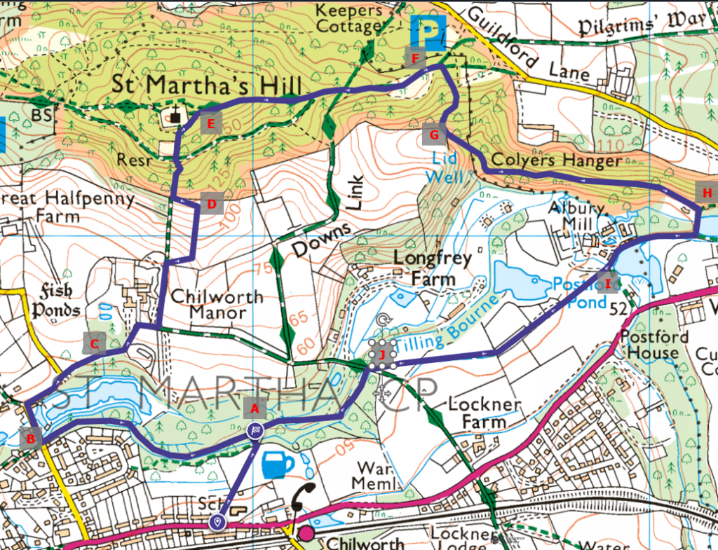
This is the first of two walks following a circular path starting from Chilworth and tracing the famous Gunpower Mill Trial along the Tillingbourne river. It includes a climb up to St. Martha’s hill.
Please follow the entire walk on . The route map is available on
.

The total distance (Part 1 and 2) covers 5 km, with a total ascent of 145 m to a maximum of about 173 m.
The first part is from waypoint A to F. The second from F to G.
The timeline of the waypoints on the video are:
A 1:21 Start
B 17:03 Halfpenny Lane
C 21:35 Old trees of Chilworth Manor
D 36:36 Viewpoint
E 43:06 St Martha’s Church
F 57:05 Near the carpark of St. Martha.
The route from A to B follows the famous Chilworth Gunpower Mill. You will pass by the derelict remains of the Corning house, where sulphur is mixed with saltpetre and charcoal to make charges. To the right is a view of the picturesque pond of Powder Mills Fishery, part of Albury Estate Fishery.
From the road, take Vera’s footpath just beside the school down to our start point.
Turn when the path joins Halfpenny Lane at B. Continue on this and bear right (C) to the field with lamas. Along the way, you pass by the gate to Chilworth Manor, a monastery in the 11th century, at least according to the Domesday Book.
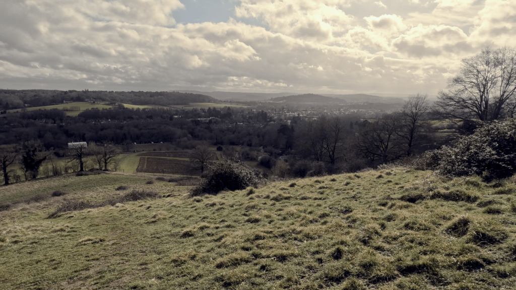
From here, turn left to go up the path that gradually overlooks Chilworth Manor on the left. Our walk up turns right mid-way up this path to walk over the open field. Continue up the steep slope to a bench at that top (D). Sit down and enjoy the view overlooking Chilworth town. Black Heath is behind the rolling hills beyond. Further left (east) is the quaint village of Albury.
Head back to the path. This is the steepest part of the climb. It is believed that the steepness here inspired John Bunyan’s Hill of Difficulty in Pilgrim’s Progress. All this work is well worth it when at the summit with St. Martha’s Church ahead and an even more breathtaking view of the surrounding countryside from this higher vantage point.
At the church’s gate and continue along the path to the right. You are now on the Pilgrim’s Way was described in Archaeologia Cantiana (1925) as “… probably no other road or trackway in the whole of England that can boast such a literature as does this path, around which myth, legend, history, enthusiasm, and tradition, have combined to weave a very tangled web. Running as it does through some of the most charming parts of the south country, Hampshire, Surrey, and Kent generally on the southern slope of the chalk hills, but at times traversing ploughed fields, along deep sandy hollow ways or through gloomy yew-lined avenues, it can be followed from Winchester and the West to Canterbury and the Coast.”
Our walk continues gently down the hill to F. Do take note that the small footpath turning off to the right is not easy to find.
Continue to Part 2 of our walk from F to J
Too tired to continue? You can take a shortcut to return to the starting point. A path about 300 m from E to the right takes you along a small section of the Downs Link. You will be rewarded with a view ahead and fields to the left before arriving at the Chilworth vineyard. From there, you can rejoin our walk at either C or J.

