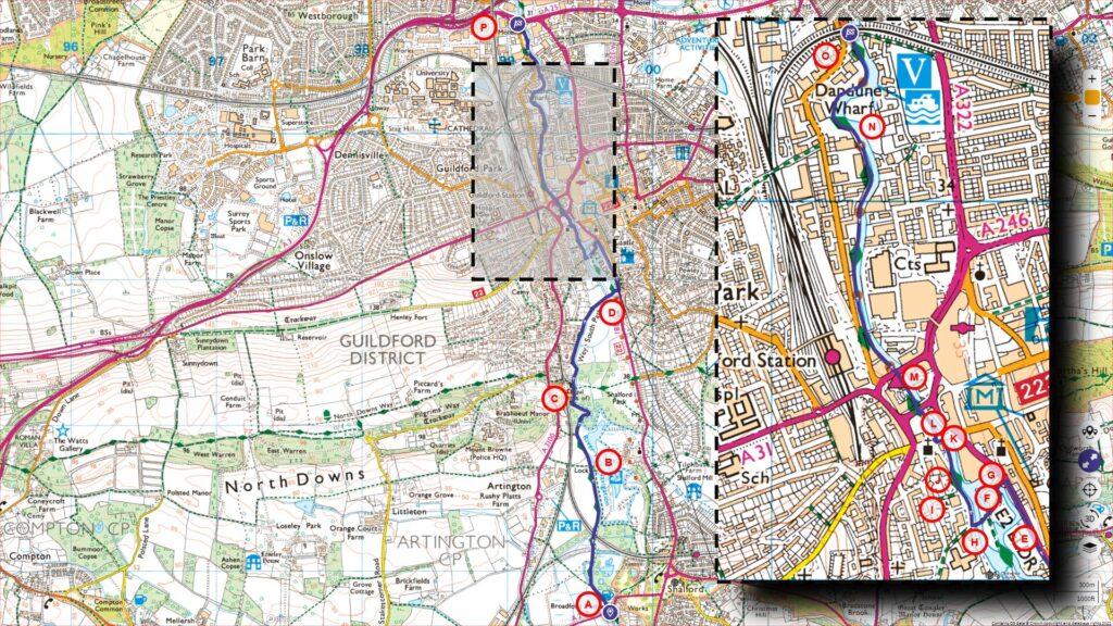
This episode is a continuation of our exploration along the Wey Navigation, which initially commenced from Godalming. The previous segment of this journey, be it in video or blog form, concluded at Broadford.
Follow the entire walk on . The route map is available on
.

A:Broadford
B:St Catherine’s Lock
C:St Catherine’s Hill
D:Guildford Rowing Club
E:Quarry Street
F:Town Mill
G:Yvonne Arnaud Theatre
H:Millmead Lock
I:Westyne Garden
J:Alice and the White Rabbit
K:Town Bridge
L:Treadmill crane
M:Friary Bridge
N:Dapdune Wharf
O:The Seven Arches (Railway Viaduct)
P:Ladymead
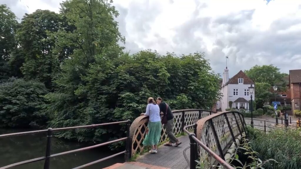
Broadford [A], a picturesque hamlet, grapples with the challenge posed by fast-driving motorists that dart across its delicate iron bridge, connecting Shalford to Peasmarsh. The name Broadford harks back to an age when there was a ford here, long before the introduction of the bridge.
Journeying a distance of five hundred meters downstream, you will encounter the railway bridge, a structure from 1859 that supports the rail line linking Reading, Guildford, and Redhill.
A little further from this bridge, one discovers St Catherine’s Lock [B]. This lock, which dates back to 1764, was birthed alongside the advent of the Navigation trade. It nestles within an isolated section of the Navigation, with its surroundings painted by verdant meadows. Distinctively, this lock doesn’t feature an accompanying keeper’s cottage or any additional edifices.
The stretch from Broadford to St Catherine positions the towpath in a straight line headed north, framed by sprawling meadows on both sides. Progressing through, the towpath begins to weave, offering visitors the comforting embrace of overhead tree canopies.
As you follow the towpath, the sight of St Catherine’s Hill [C] unfolds before you. The hill, draped in hues of golden-orange sands, elegantly descends to meet the river’s embrace. Atop this hill, though not directly visible from this vantage point, are the remains of St. Catherine Chapel. To get a panoramic view of the chapel, as well as a depiction of the descent leading to this towpath and subsequently the bridge into Shalford Park, kindly refer to our North Downs Way walk (Timetamp 1:28:15 to 1:34:50).
Exiting the forested area preceding St. Catherine’s Hill, the towpath flanks opulent residences to the left. Their lush gardens are bordered by wooden barriers abutting the towpath. This signals the commencement of the River Wey’s serene voyage through Guildford’s energetic core.
About five hundred meters forward, the river takes a crisp 90-degree bend heading north. Located at this curve is the Guildford Rowing Club [D] on the opposing bank. It’s quite commonplace to see canoes from this club gracefully charting the Wey’s waters, moving in the opposite direction of our path.
On the near bank, you’ll discover a charming island park, replete with seating benches. It’s an idyllic spot for a picnic, especially if the contemporary eateries or upscale pubs in the vicinity don’t resonate with your preferences. This particular towpath culminates in a substantial weir to the north, which isn’t accessible. To resume on the primary towpath, traverse the metal footbridge and make a left onto Quarry Street [E], guiding you northward. Adjacently, on your right side, landmarks like Castle Cliffe Gardens, Rack’s Close Park, and the illustrious Guildford Castle present themselves. For an in-depth exploration of these attractions, we invite you to view our Guildford Town walk video.
In an approximately four hundred meters your arrived at the Town Mill [F]. This site boasts a storied history, having housed a mill since the year 1295. To the left is the Yvonne Arnaud Theatre [G]. Established in 1965, this theatre pays homage to the iconic French actress after whom it is named. Adjacent to the theatre stands
Venture down the walkway on the theater’s left side, directing you towards its rear. Here, Millmead Lock [H] unveils itself. This lock holds the distinction of being the final lock within the Godalming Navigation series. It saw its inauguration when the canal stretching from this point to the Godalming Terminus was fully realized in 1764. This lock sits at a distance of 24.8 kilometres from the Thames River.
Onward from the Millmead Lock, cross the bridge and embark on the towpath. As you saunter past Westyne Garden [I] on your left, be on the lookout for the enchanting statue of Alice and the White Rabbit [J], nestled beneath the willow trees. The path leads towards the Town Bridge [K], unveiling a glimpse of Guildford’s storied past, especially the site named Gyldeforda, or the Golden Ford, which bestowed the town with its moniker.
As you promenade along the river’s edge, with a parking facility to your right, cast your gaze across the river to spot a meticulously restored treadmill crane [L] from the year 1726, poised before the Friary Bridge [M]. This artifact harks back to an era when the canal’s banks were punctuated with wharves and breweries, stretching up to Daphune Wharves and even further.
Dapdune Wharf [N] graces the river’s eastern bank. The National Trust has diligently restored this location, making it accessible to the public. Historically, Dapdune Wharf emerged as the epicenter for barge manufacturing for the Wey Navigations.
In proximity to Dapdune Wharf, the majestic brick railway viaduct [O], built in 1885, stands tall. Locals fondly refer to it as ‘the seven arches’.
Our journey now approaches its conclusion as we arrive at Ladymead [P] on the A25. This region in Guildford serves as a commercial nexus, home to expansive warehouse outlets, supermarkets, and the Ladymead Retail Park, where one can find a diverse array of stores offering electronics, furniture, apparel, and various fast-food establishments.
This marks the end of our visual odyssey along the Wey Navigation. Do stay engaged for our upcoming segment, where we’ll traverse the stretch from here all the way to Bowers Lock.

